Is Olympus Mons really the Solar System’s highest mountain?
2026-10-05 06:00
776 views
Planet Earth possesses many impressively large mountains.
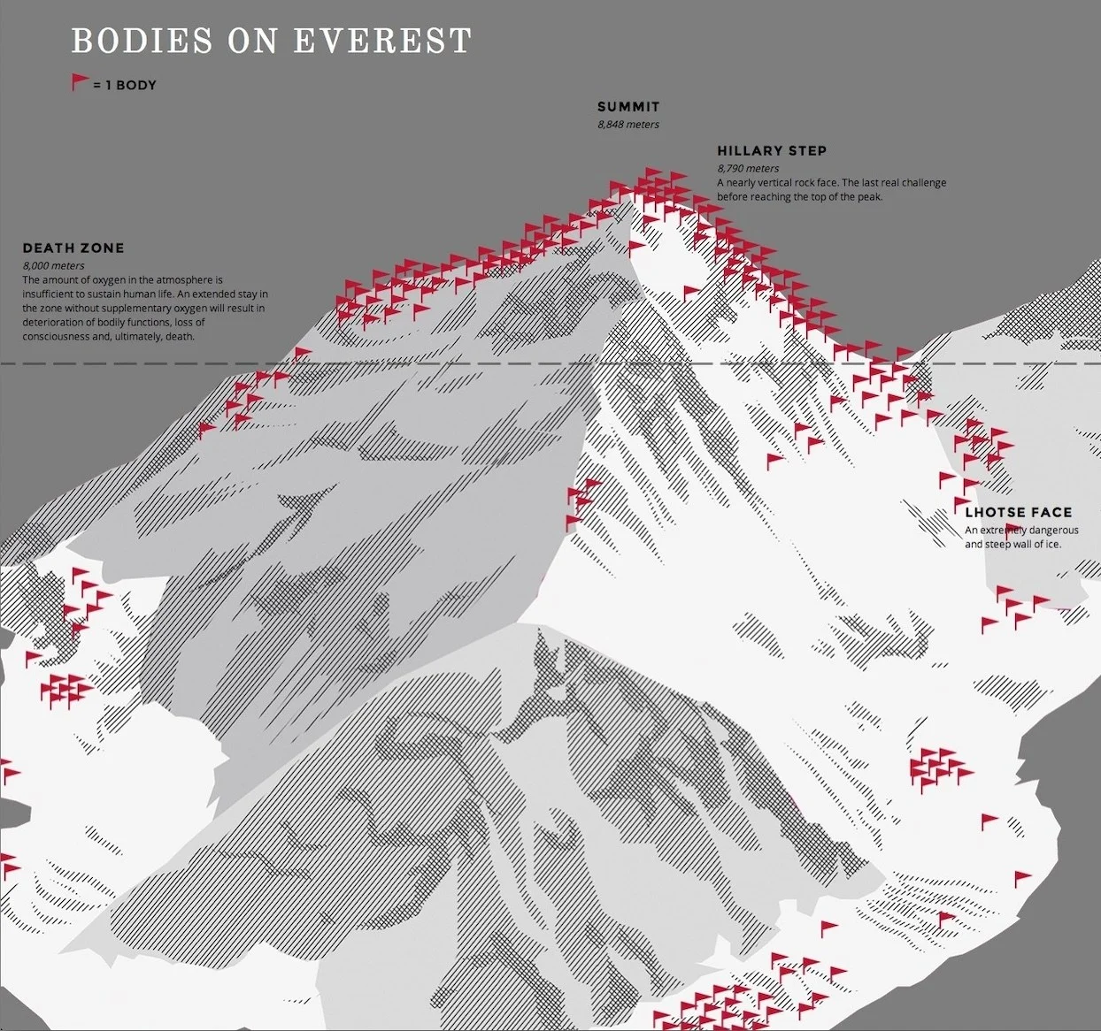
This map shows the number of bodies located near the summit of Mt. Everest, the highest point above sea level on the surface of planet Earth. ...
Planet Earth possesses many impressively large mountains.
This map shows the number of bodies located near the summit of Mt. Everest, the highest point above sea level on the surface of planet Earth. Although it was long thought that terrain would be the most significant contributing factor to deaths on the mountain, the distribution of bodies shows that the main culprit is not terrain, but rather elevation that is the determining factor.
Mount Everest represents the surface’s highest point, peaking 8.849 km (29,032 feet) above sea level.
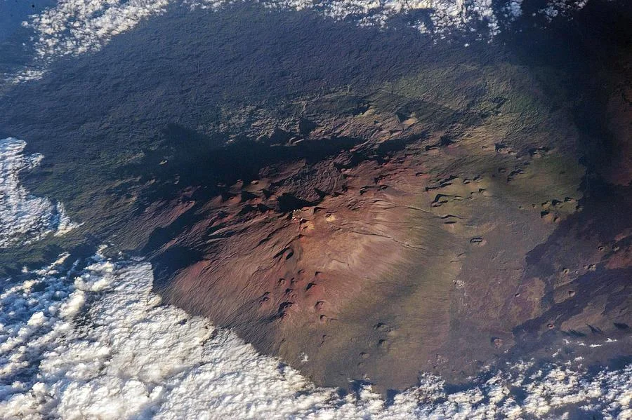
Even as viewed from space, captured here from the International Space Station, Mauna Kea’s summit is an incredibly impressive site. From sea level, it rises up 4,205 meters (13,800 feet) above the oceans, but sinks an additional 5000 to 6000 meters down to the sea floor, making it the highest mountain, base-to-peak, of any feature on Earth. It is thought to be completely extinct, having last erupted more than 4000 years ago.
From base-to-peak, however, many volcanic mountains surpass it, including Mauna Kea, with a dry prominence of 9.33 km (30,610 feet).
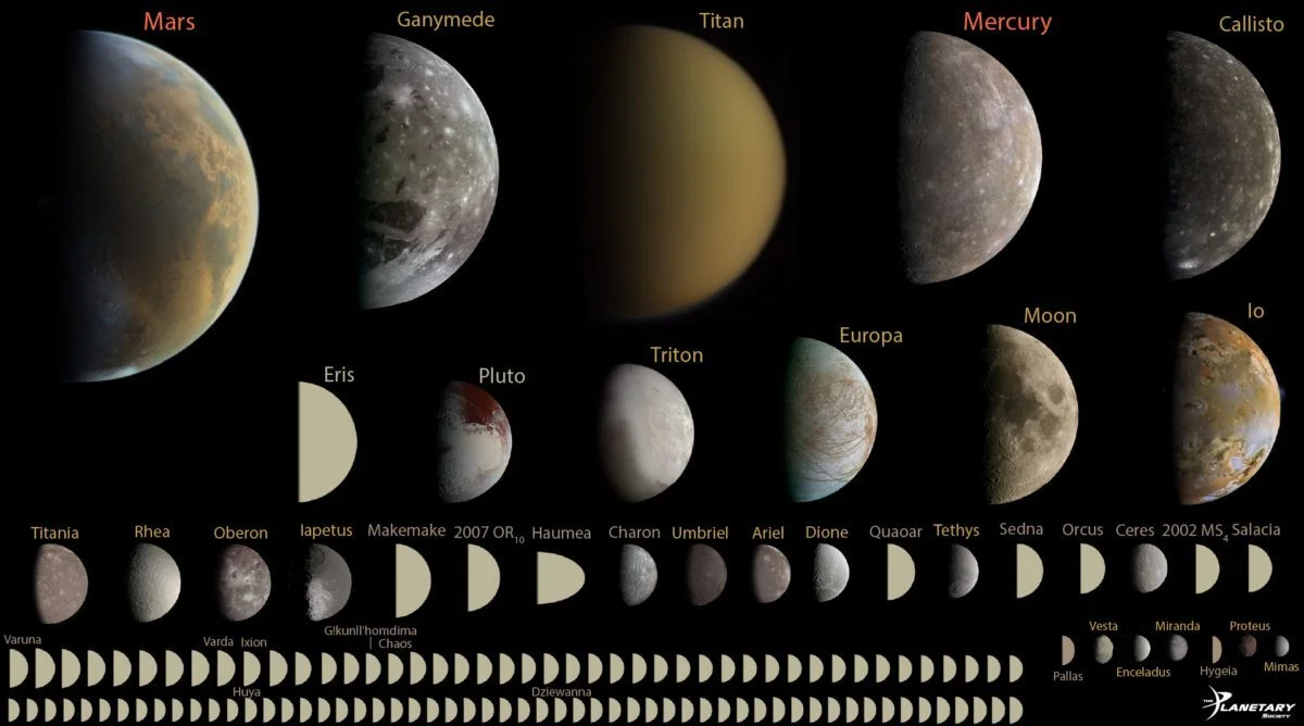
Although Earth and Venus are the two largest rocky objects in the Solar System, Mars, Mercury, as well as over 100 of the largest moons, asteroids, and Kuiper belt objects have all achieved hydrostatic equilibrium. Ganymede and Titan are larger than Mercury, but Callisto, at 99% of Mercury’s size, has just one-third of Mercury’s mass. The lesser in mass an object is, the greater its departure from perfect sphericity can be.
Credit: Emily Lakdawalla. Data from NASA / JPL, JHUAPL/SwRI, SSI, and UCLA / MPS / DLR / IDA, processed by Gordan Ugarkovic, Ted Stryk, Bjorn Jonsson, Roman Tkachenko, and Emily Lakdawalla
Lower-mass planets are less rounded, whereas Earth is the Solar System’s most massive solid-bodied world.
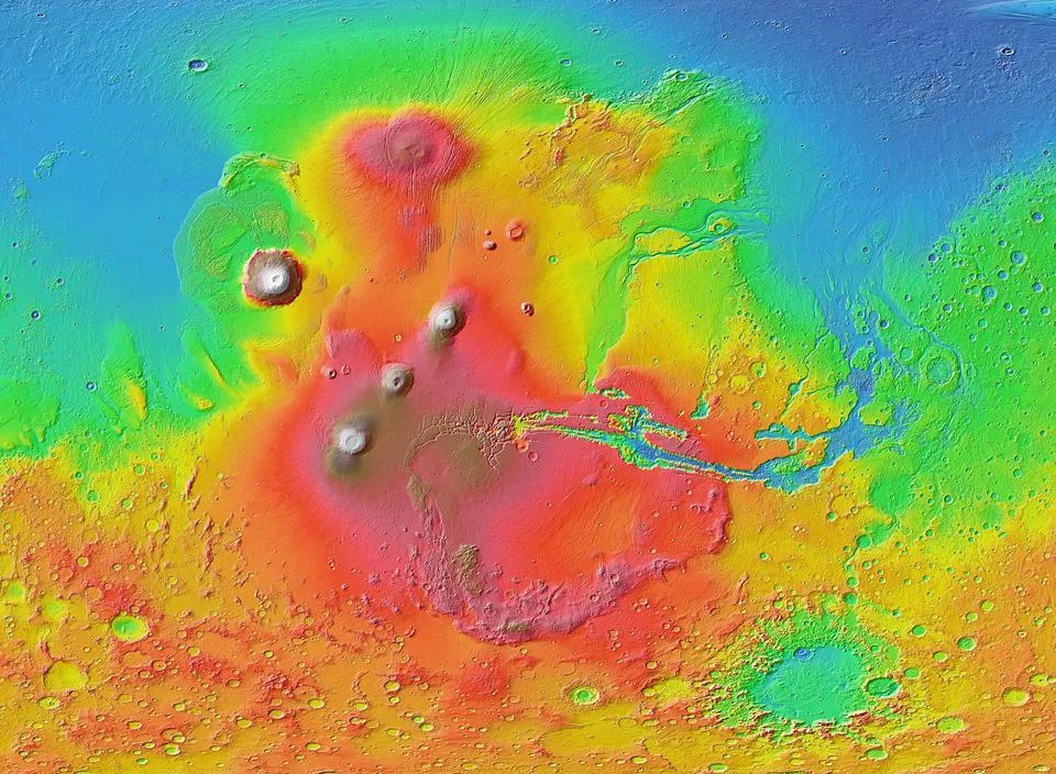
Mars Orbiter Laser Altimeter (MOLA) colorized topographic map of the western hemisphere of Mars, showing the Tharsis and Valles Marineris regions. The impact basin Argyre is at lower right, with the lowland Chryse Planitia to the right (east) of the Tharsis region. Olympus Mons, near the upper-left, is the largest and tallest of the four major tall planetary volcanoes shown here on Mars.
Credit: NASA/JPL-Caltech/Arizona State U./Mars Global Surveyor MOLA Team
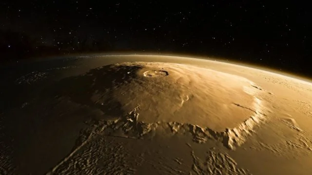
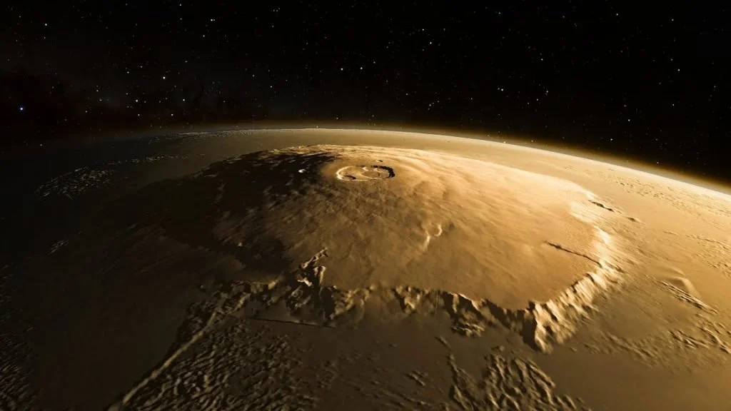
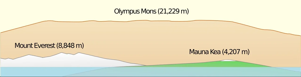
This side-view shows a comparison, from sea level to the peak, of Olympus Mons on Mars, Mount Everest on Earth, and Mauna Kea on Earth, with Mauna Kea’s full extent shown beneath the line representing sea level. Olympus Mons has grown so large due to a variety of factors: Mars’s lack of continental drift and Mars’s lower gravity compared to Earth chief among them.
That’s 0.65% of Mars’s radius, as opposed to 0.16% of Earth’s for Mauna Kea.
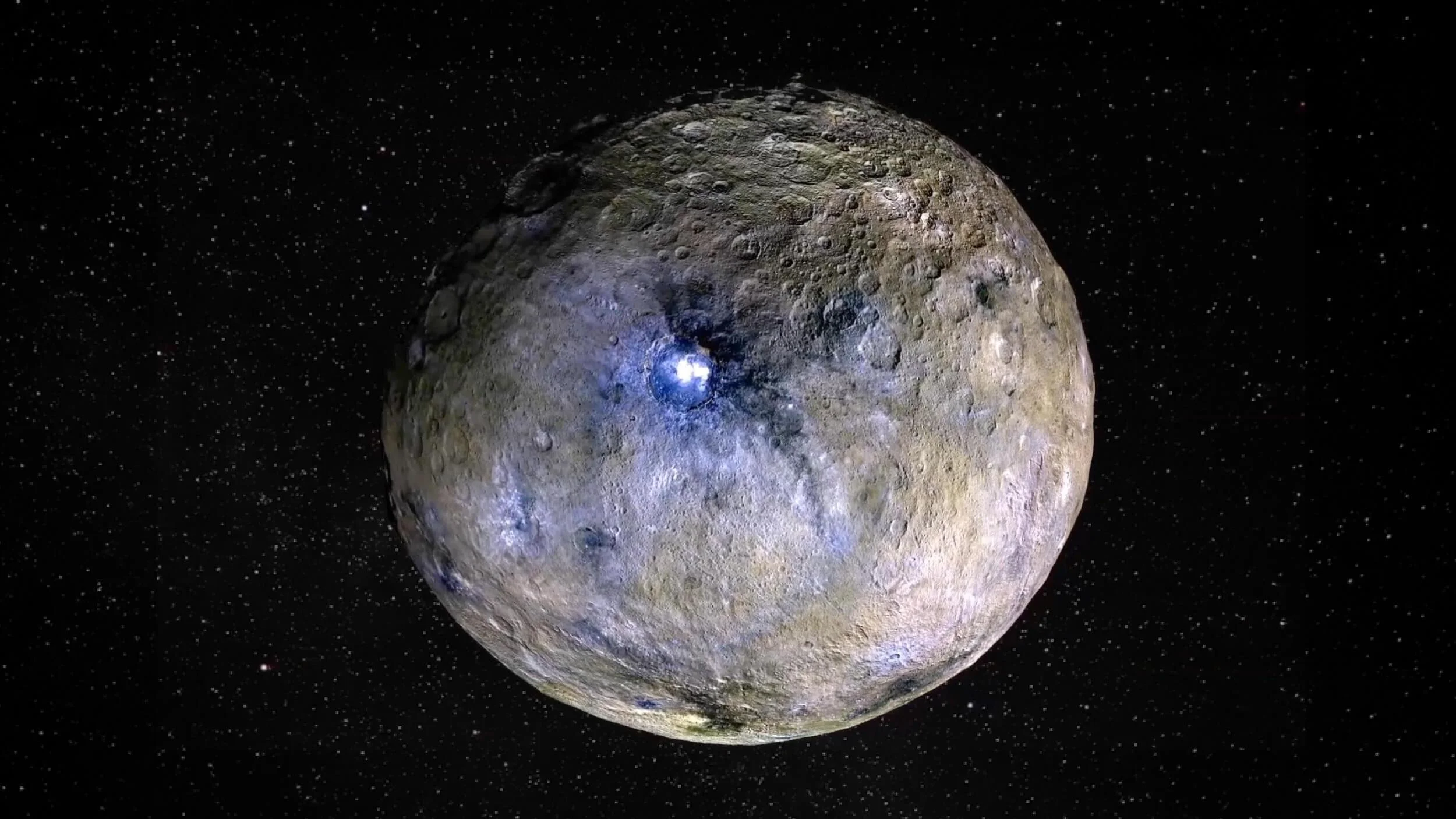
The dwarf planet Ceres, shown here, is the largest world in the asteroid belt and the only one known, for certain, to be in hydrostatic equilibrium. Discovered in 1801 by Giuseppe Piazzi, it was originally classified as a planet: then the Solar System’s 8th, and is known today to represent about 40% of the asteroid belt’s total mass. It has a cryovolcanic mountain, Ahuna Mons, that rises up 4 kilometers from base-to-tip, 0.85% of Ceres’s total radius, antipodal to Ceres’s largest impact basin.
Even lower-mass worlds possess relatively – and potentially, even absolutely – impressive features.
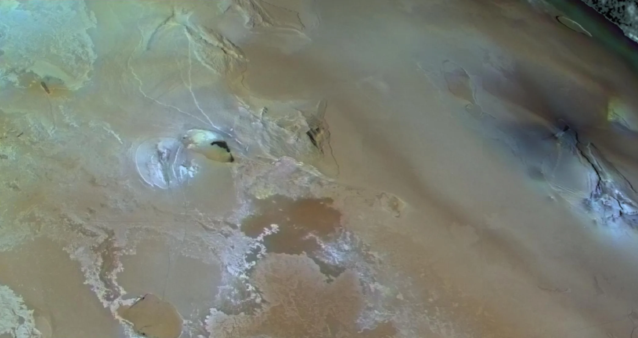
The highest peak on Jupiter’s moon Io is the southern peak of Boösaule Montes, which is found near the center of this image. Ranging between 17.5 and 18.2 km from base-to-peak, it also has a 15 kilometer high scarp running across its southeastern flank. Its height is approximately 1% of Io’s total radius.
Jupiter’s moon Io has the tectonic South Boösaule Montes: 1.0% of its radius and 17.5-18.2 km high.
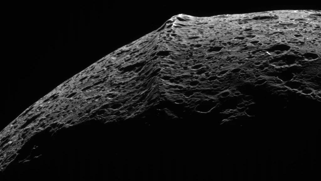
The giant equatorial ridge running along Iapetus is unique in the Solar System. This ridge-like feature traces out some of the Solar System’s highest mountains, rising 20 km from base to peak, although the nature and origin of the ridge remains an open question. It could be, as some have suggested, the remnant of a once-destroyed moonmoon (satellite of Iapetus) that has since fallen back down onto the world.
Credit: NASA / JPL-Caltech / Space Science Institute / Cassini
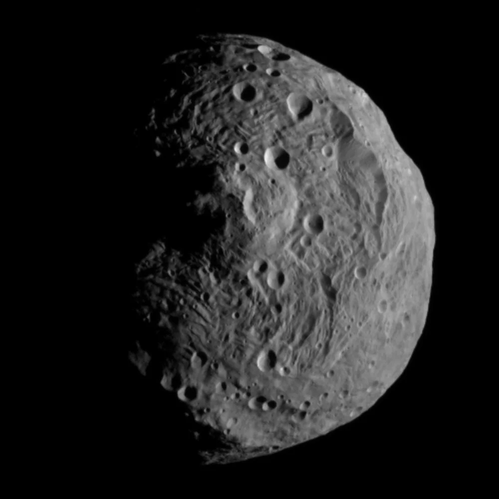
This image shows the enormous impact basin Rheasilvia on asteroid 4 Vesta, taken by the Dawn spacecraft on July 11, 2011. Rheasilvia is 505 km in diameter, whereas Vesta itself is only 569 km in diameter around its equator. The peak at the center of the impact basin rises up anywhere from 19 km to 25 km, meaning that, with better measurements, we may yet find that Rheasilvia’s central peak, caused by an impact, has a higher base-to-peak height than Mars’s volcanic Olympus Mons.
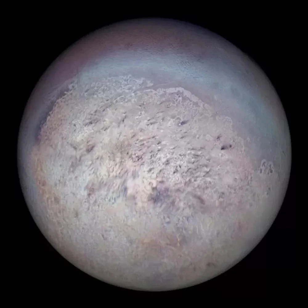
This image shows a composite of Neptune’s giant moon Triton, assembled from Voyager 2 imagery at the highest possible resolution. The dark streaks come from cryovolcanic geysers, also known as black smokers, from Triton’s south polar region. While the known features on Triton only span about 1% of its radius from base-to-peak, we have yet to image its full surface, or the full surface of any moon of Uranus or Neptune. Other than Voyager 2’s flyby of those worlds, and New Horizons’ flyby of Pluto, no solid body beyond Saturn’s orbit has been imaged in full.
These three latter measurements occurred in 1979, 2004, and 2011, respectively.
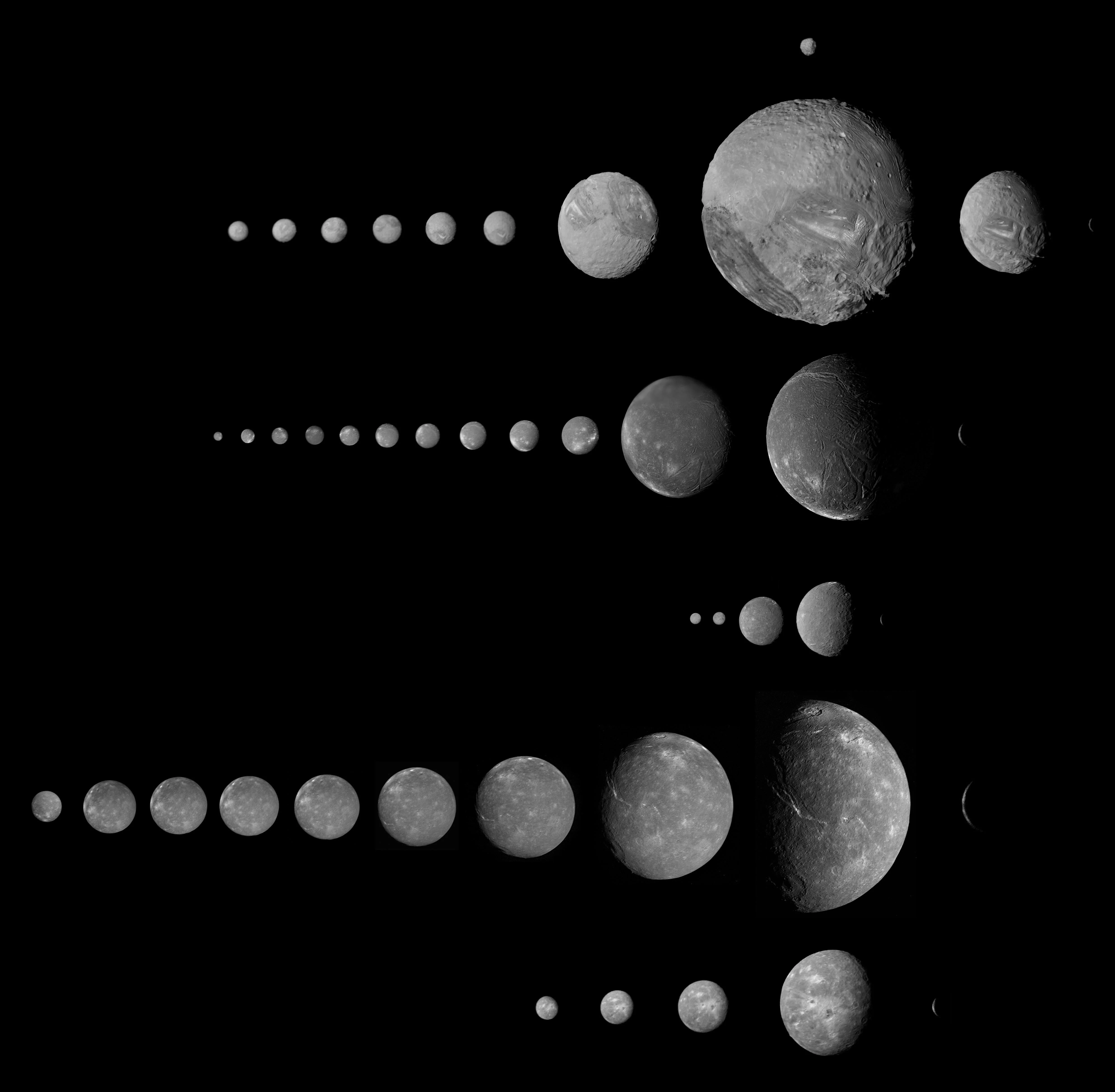
From top to bottom, the Uranian moons of Puck, Miranda, Ariel, Umbriel, Titania, and Oberon are shown as imaged several times, from approach to departure, by Voyager 2 during its flyby in 1986. A complete map of these moons and their features has not yet been possible from the existing data, nor has any planned orbiting mission beyond Saturn been selected and funded.
Uranus’s and Neptune’s moons, plus all trans-Neptunian objects, remain largely unmapped.
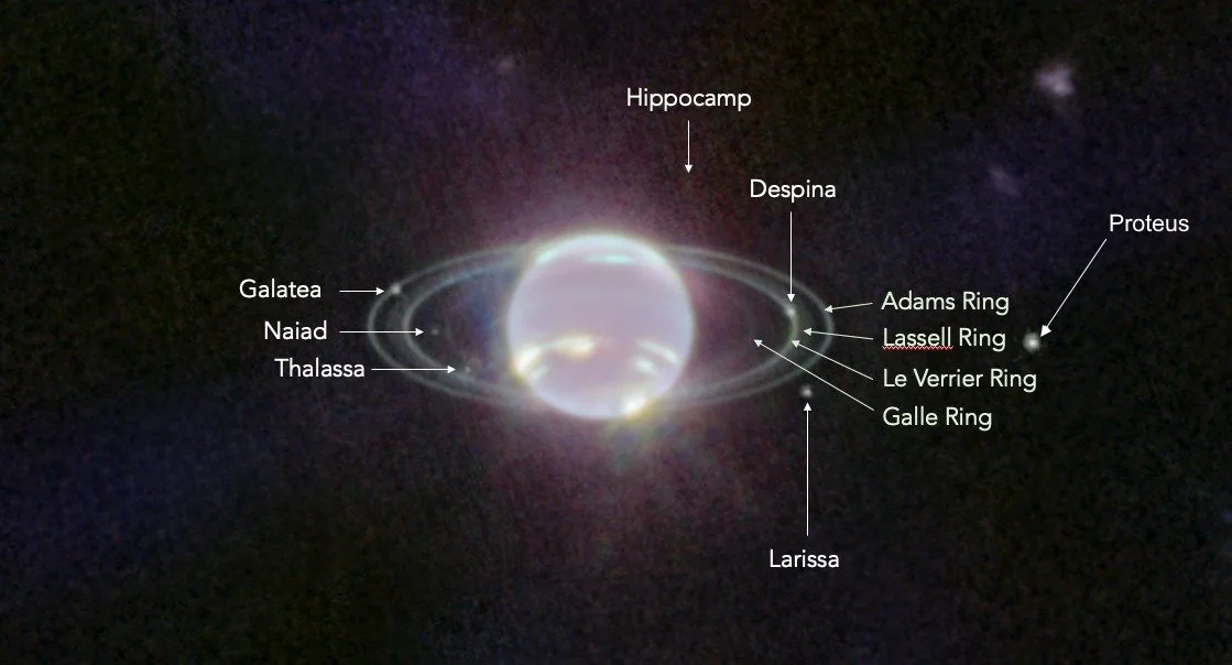
Numerous features surrounding Neptune, as identified in the JWST images. All 7 of Neptune’s inner moons can be seen here, along with the two main rings and two dusty, more diffuse rings. These moons, as well as most of the moons around Neptune and Uranus, have never been imaged by an in situ spacecraft.
Credit: NASA, ESA, CSA, and STScI, annotations by H. Hammel and E. Siegel
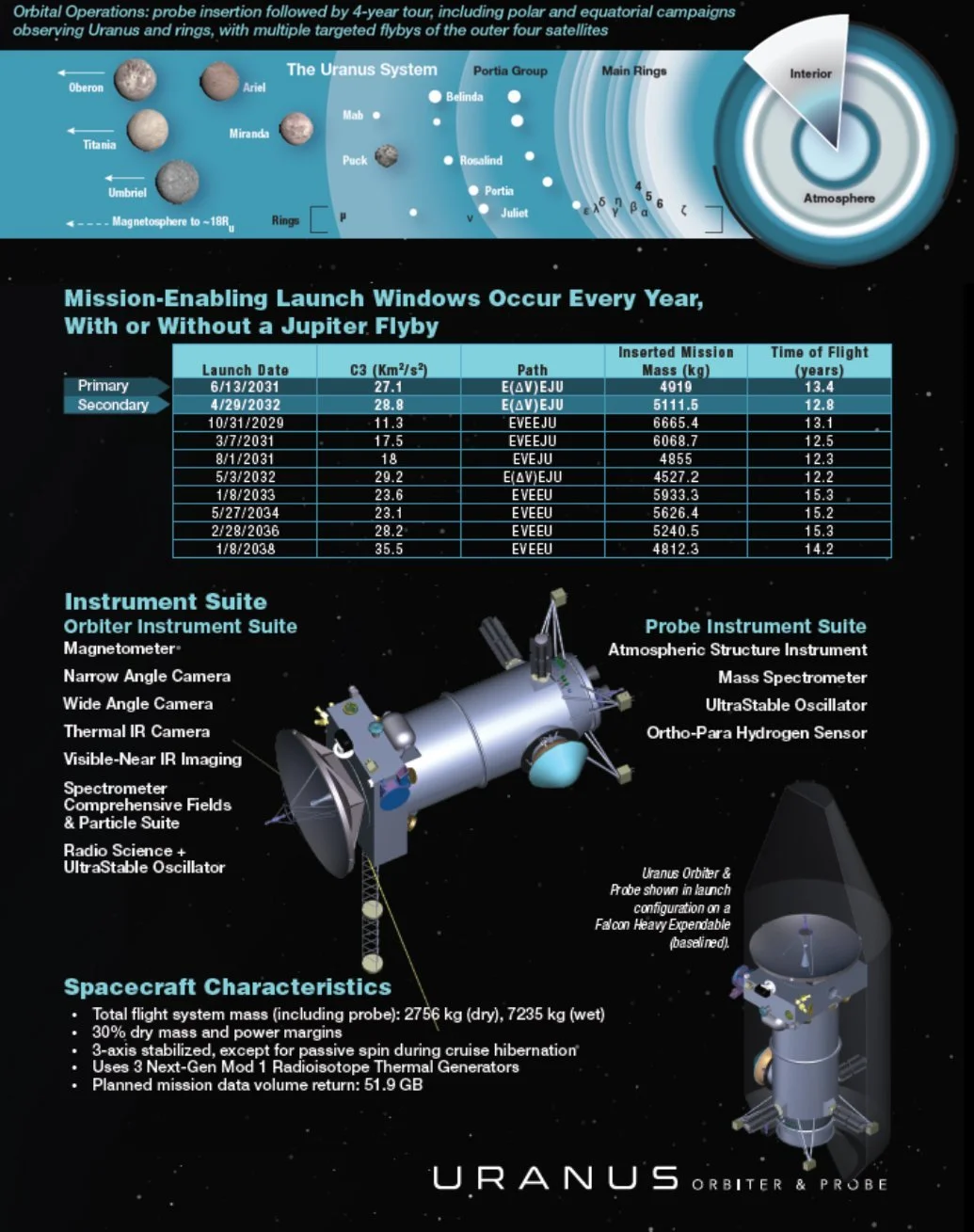
Although the ideal launch window for an orbiter-and-probe mission to Uranus occurs between 2030 and 2034, our expected spaceflight capabilities in the 2030s should allow this mission to arrive in or near Uranian equinox, giving us a never-before seen, close-up view of our Solar System’s 7th planet.
Until that’s done, we cannot conclude whether Olympus Mons is truly the highest.
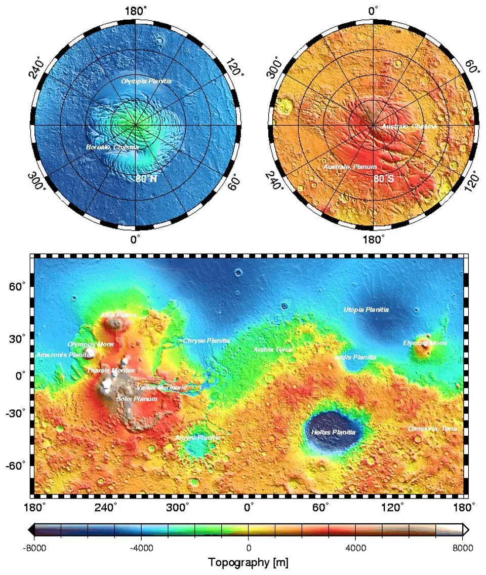
The Mars Orbiter Laser Altimeter (MOLA) instrument, part of Mars Global Surveyor, collected over 200 million laser altimeter measurements in constructing this topographic map of Mars. The Tharsis region (center-left) is the highest elevation region on the planet, while the lowlands appear in blue. Note the much lower elevation of the northern hemisphere compared to the southern, thought to arise from the fallback of a third, large, former Martian moon. While we can be confident that Olympus Mons is the highest mountain on any major planet of the Solar System, other planetary bodies may yet have greater base-to-peak heights.